


Roundhouse Park from Above! - Part 1 of 2: Googling It!
 Click on each picture for a closer look!
.
Google Maps and Microsoft's Bing Earth are two exciting services that have appeared on the Internet in past few years. They provide us with the opportunity to explore areas through online maps, satellite images and overlaid photos and videos and even links to Wikipedia. In this pair of News postings, we will show how Roundhouse Park appears in this media and encourage you to go exploring yourselves.
.
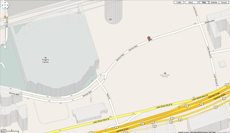
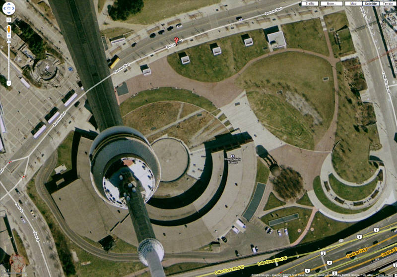
If you go to Google Maps and enter the address for Roundhouse Park (255 Bremner Blvd, Toronto, ON) , you will see the street map for the area as shown in the image at the left above. If you switch the view to "aerial", you will see the satellite image for Roundhouse Park (as shown at the right above) with the CN Tower overshadowing the Roundhouse. As you can see, this satellite picture is quite dated as it was taken well before park renovations began.
.
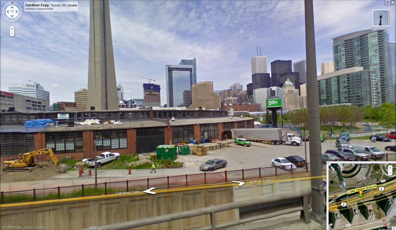
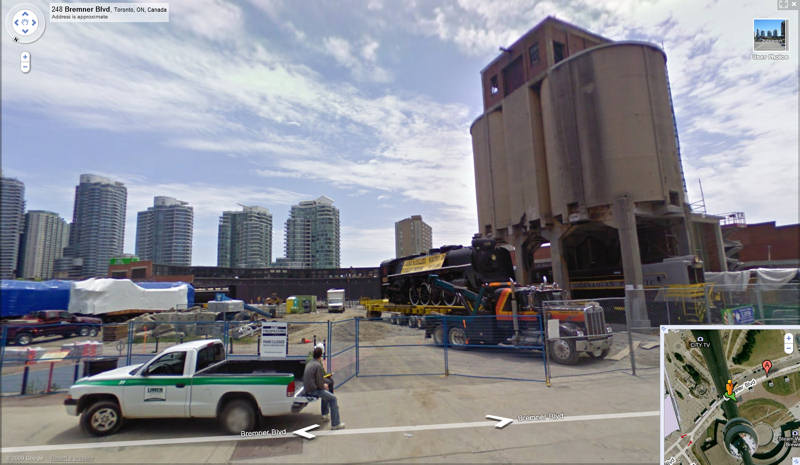
Over the past few years, Google has been sending photographics vehicles to take 360 degree panoramic images of city streets so that you can click on a spot on a street and then see and rotate a visual image as if you were standing at that spot. To do this, click on the little orange human figure at the top of the vertical zooming scale at the upper left of the Google image and drag that figure onto a spot on any of the streets bounding Roundhouse Park.
.
Below, we show two of the many views that you can access through this feature. In the first one, we see an image taken from the Gardiner Expressway of the south side of the Roundhouse. In the second, we have a view from Bremner Boulevard. This second view dates the photography session closely as we find #6213 waiting to be unloaded from the framework used to move her to Roundhouse Park. This picture was then taken this year in June of 2009.
.
When viewing the maps in Google, you can also click on the drop menu menu under "more" in the upper right menu bar and see locations of pictures and videos which have been added to the map. However, if you click on any of these, you will find that most are of other local sites such as the CN tower at the moment.
.
To be continued!
.
Posting by Russ Milland; Images from Google Maps
.
<< Home