


From the Archives: Toronto's 1st Union Station - Part 3 of 8
 Click on the picture for a closer look!
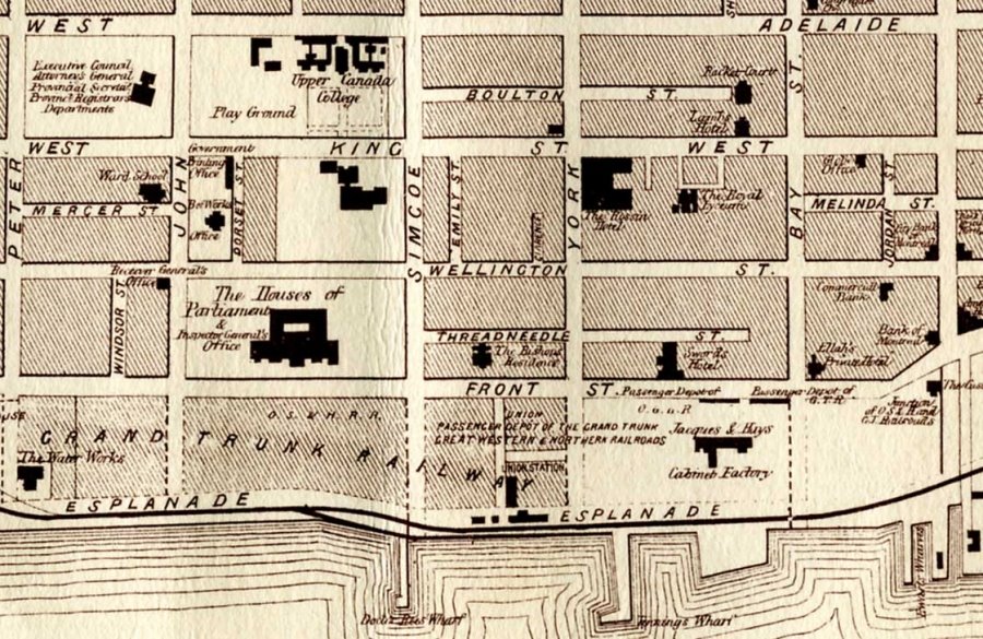
The illustration above is a reproduction of an 1858 map of Toronto and shows the location of several railway facilities. Union Station can be seen in the center of the map just to the left of the Esplanade. The two earlier stations can be seen at the corner of Front and Bay Streets. Other sites of interest include the Parliament Buildings, now the location of Simcoe Place and the CBC Broadcast Centre; Upper Canada College north of King St. and the Rossin Hotel at King and York Streets. The heavy black line indicates the railway track.
Click here to read the next in this series of excerpts from Derek's article on Toronto's 1st Union Station.
By Derek Boles, TRHA Historian
<< Home